Features
Everything You Need for Field Documentation
From photo capture to client-ready reports. Every tool built around how field teams actually work.
GPS · BEARING · EXIF · AUTO
Photo Management
Drop your photos in, and Vortyk handles the rest. GPS coordinates, camera direction, and timestamps are all pulled from the image automatically. No tagging, no sorting, no spreadsheets.
- Batch upload dozens of photos at once
- GPS and timestamps extracted automatically
- Camera bearing and direction captured
- Custom captions on every photo
- JPEG, PNG, HEIC, and WebP supported
- Flags photos missing location data
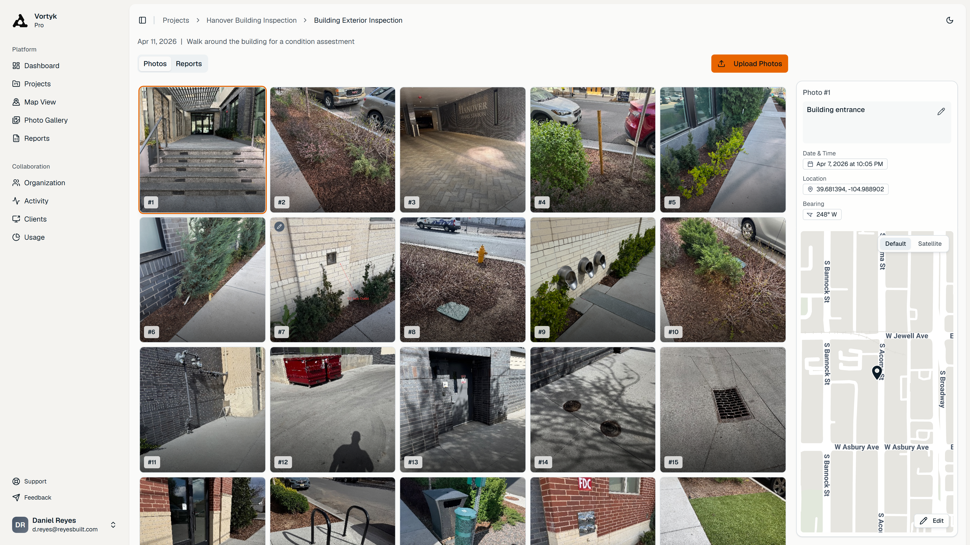
39.681394, -104.988902 · 248° W
Interactive Maps
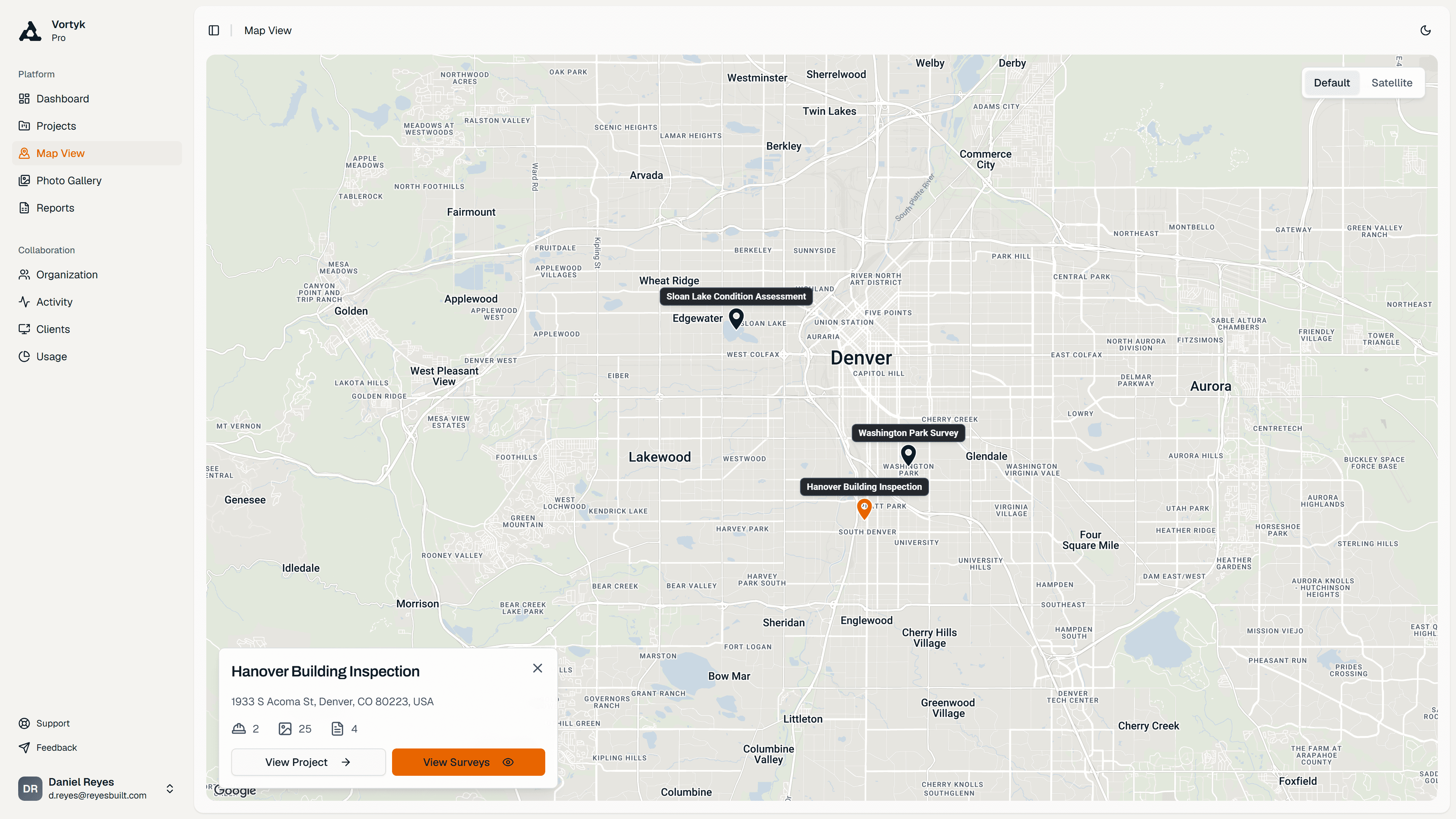
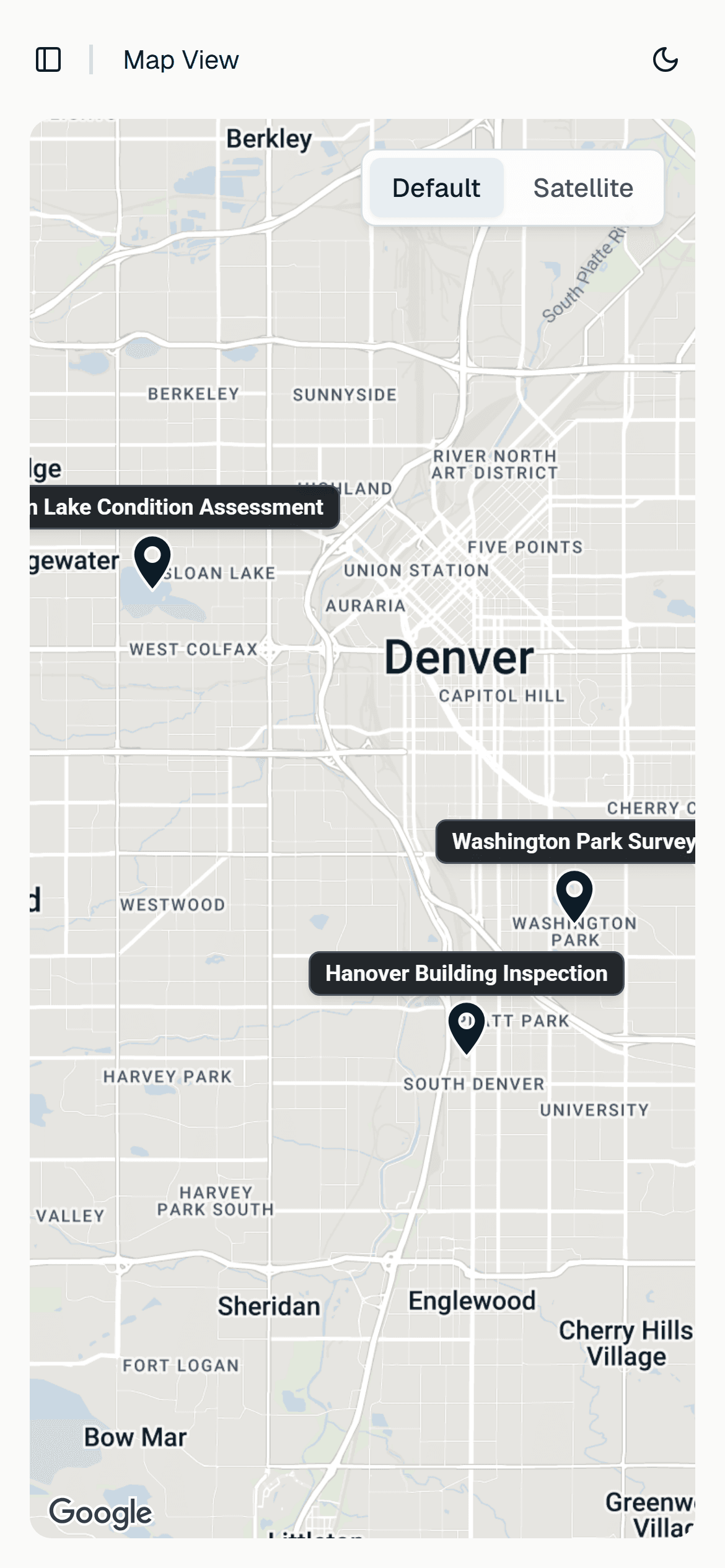
See every photo pinned to its exact GPS location. Zoom out to see all your projects on one map, or zoom in to see individual photo positions within a survey.
- Every photo pinned to its GPS location
- Thumbnail previews on each map pin
- Marker clustering at any zoom level
- Satellite and roadmap view toggle
- Click any pin for full photo details
- Light and dark map themes
50 PHOTOS · PDF IN UNDER 2 MIN
Report Generation
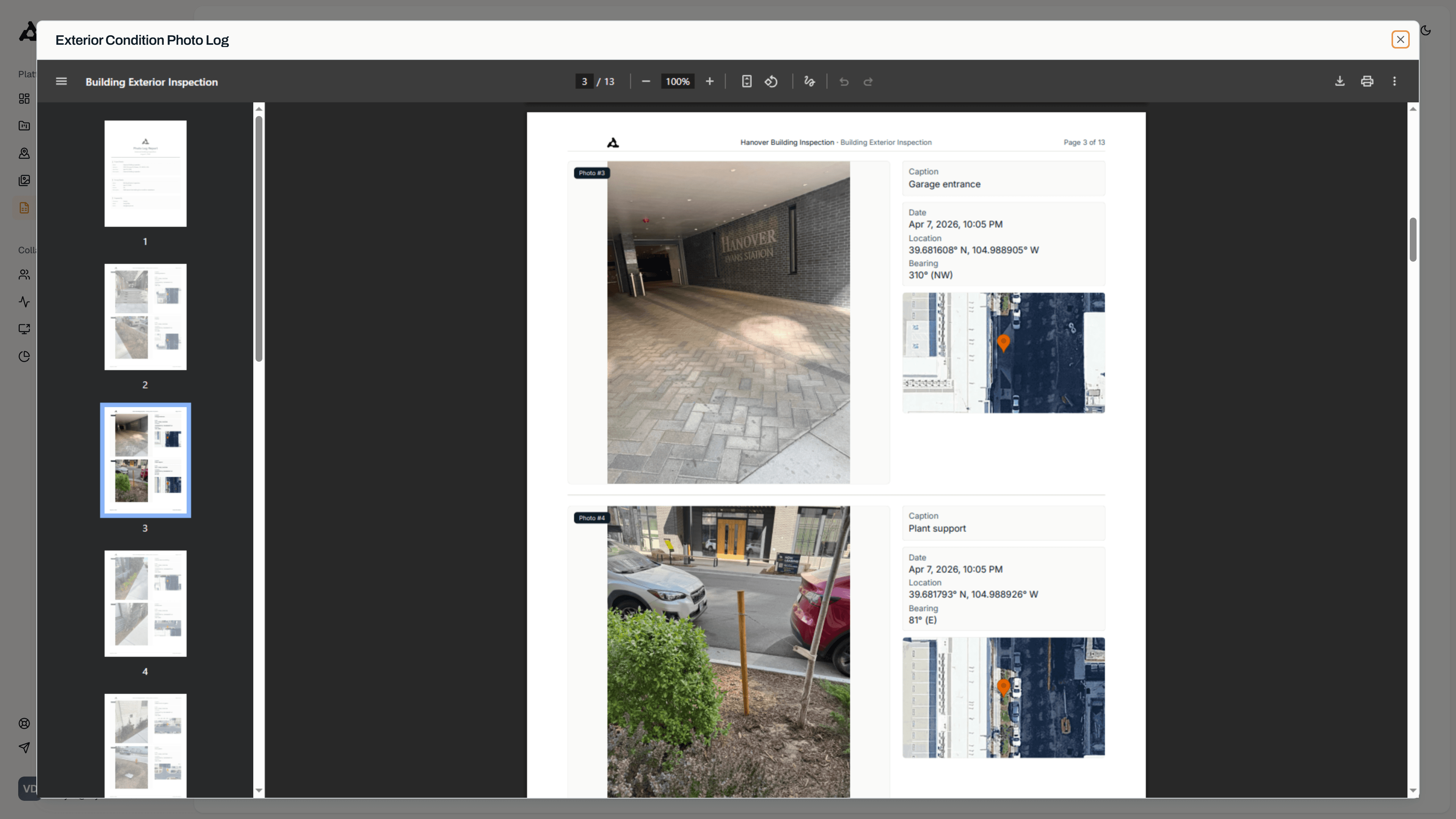
One click. Professional PDF photo log with GPS coordinates, timestamps, captions, and your company branding. A 50-photo report builds in under 2 minutes.
- One-click PDF photo logs from any survey
- 1 or 2 photos per page layouts
- GPS, captions, and timestamps included
- Your company branding on every report
- Annotations carry over to report photos
- Browse and manage all reports centrally
And everything around the photos
Markup, organization, sharing, and the controls that keep client work professional.
Photo Markup & Annotation
Draw directly on your photos to highlight what matters. Arrows, shapes, and text all auto-save and carry over to your reports. No separate editing tool needed.
- Arrows, rectangles, circles, and text tools
- 5 annotation colors to choose from
- Adjustable stroke width, fill, and opacity
Project & Survey Management
Each project gets its own workspace with surveys, photos, and reports. Find anything instantly. Know exactly how many photos and reports you have at a glance.
- Unlimited projects with no caps
- Google Maps location autocomplete
- Active, completed, and archived statuses
Team & Organization Management
EnterpriseSet up your organization, invite your team, and assign roles. Everyone works from the same dashboard with shared project access and consistent branding.
- Owner, Admin, and Member role permissions
- Invite and remove members by email
- SSO with corporate identity providers
Client Sharing
Send your client a link. They view photos, browse the map, and download reports. No app install, no account signup. You control the password and expiration.
- Password-protected links with expiration
- Clients view photos, maps, and reports
- No app install or signup for clients
Dashboard & Analytics
Your command center. See projects, surveys, photos, and reports at a glance. Track upload patterns, report output, and storage usage over time.
- Projects, photos, and reports at a glance
- Activity timeline across your account
- Upload trend charts over time
Security & Data Protection
Your data stays yours. Row-level security, encrypted storage, signed URLs, and strict ownership verification on every request. Built for compliance, not just convenience.
- Row-level security on every request
- Ownership verification on all mutations
- Encrypted passwords with bcrypt hashing
What are you waiting for?
Still wasting hours on field reports?
Get your first report in 5 minutes.
Launching soon · 14-day free trial at launch